
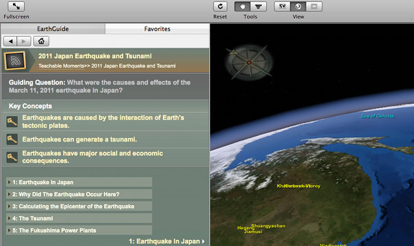
Teachable Moment:
The Layered Earth makes it easy to capture student attention by examining the geological forces at work behind current events. Here we assemble some useful tools for teaching current events in the classroom.
Japanese Earthquake & Tsunami
On Friday, March 11, 2011, Japan experienced a catastrophic earthquake at 2:46:23 pm local time (12:46:23 am EST). The earthquake occurred off the coast of the island of Honshu, approximately 80 miles (129 km) east of the community of Sendai. The 9.0 Richter magnitude earthquake and the resulting tsunami have provoked the largest crisis that Japan has encountered since the end of World War II. The Honshu earthquake was the world's fourth largest earthquake since 1900 and the largest in Japan since modern instrumental recordings began 130 years ago. About 1,500 earthquakes strike the island nation every year. Minor tremors occur on a nearly daily basis.
EarthGuide Lesson Plan: Free Download for The Layered Earth
These regular updates are designed to take advantage of The Layered Earth's flexibility, to integrate current events with your curriculum.


Pictorial Lesson: Japanese Earthquake, Cause and Effects
Hover to enlarge and navigate.-
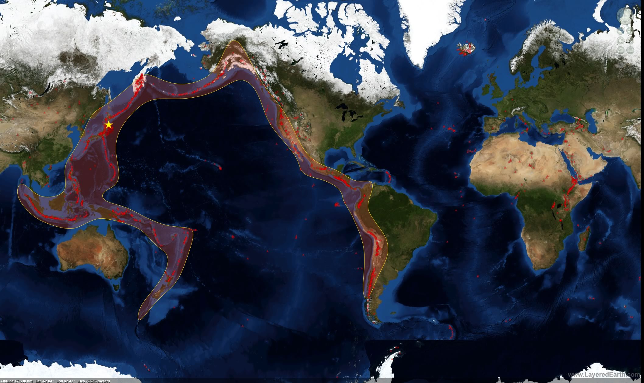
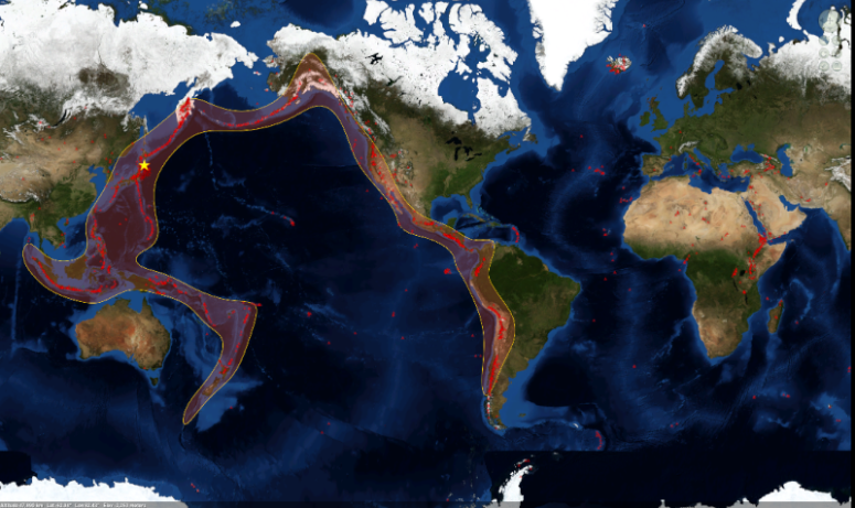 Ring of Fire
The Honshu earthquake occurred in an area known as the Pacific Ring of Fire. The Ring of Fire is a broad band around most of the Pacific. This region contains over three-quarters of the world's volcanoes and accounts for 90% of the world's earthquakes.
Download this image -
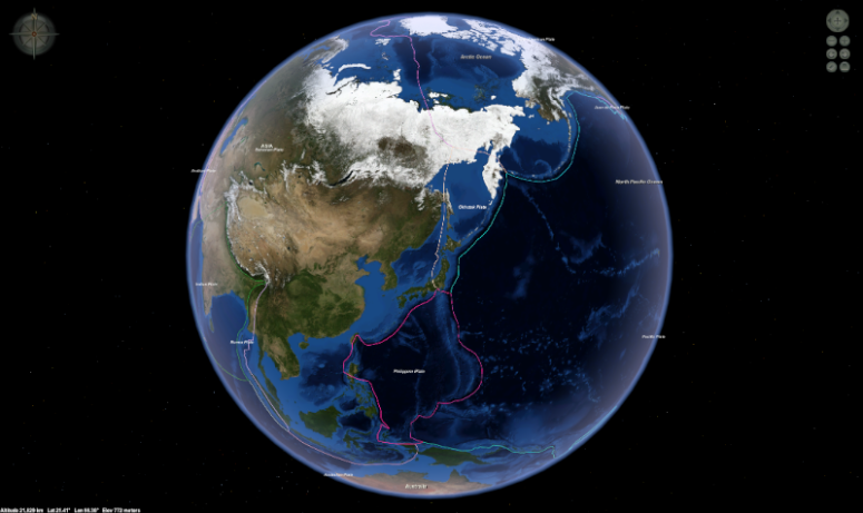 Tectonic Plates
The rigid outer shell of the Earth, called the lithosphere, is broken up into many rigid segments of different sizes and shapes.
Download this image -
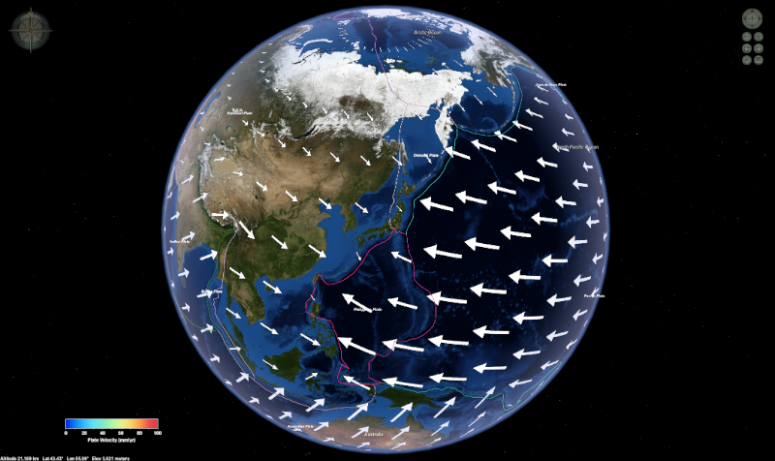 Tectonic Plate Velocity
These rigid segments, called plates, are in fluid motion relative to each other. Speed vectors show that the Pacific plate is the fastest moving on the Earth's surface.
Download this image -
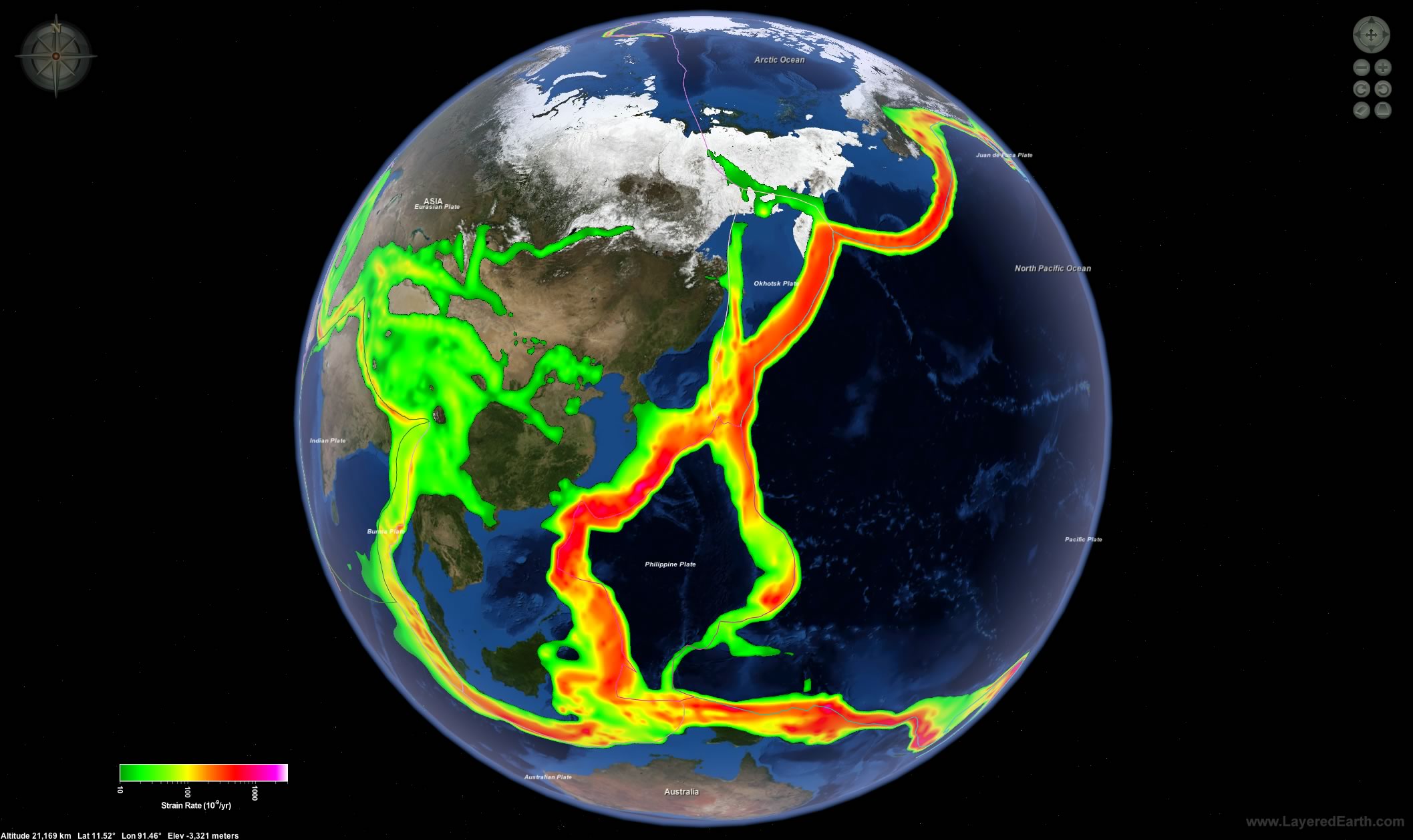
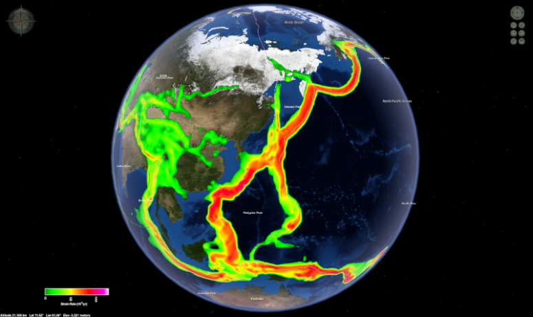 Plate Strain
As the giant plates move tremendous energies are unleashed along their borders, resulting in tremors that transform Earth's surface.
Download this image -
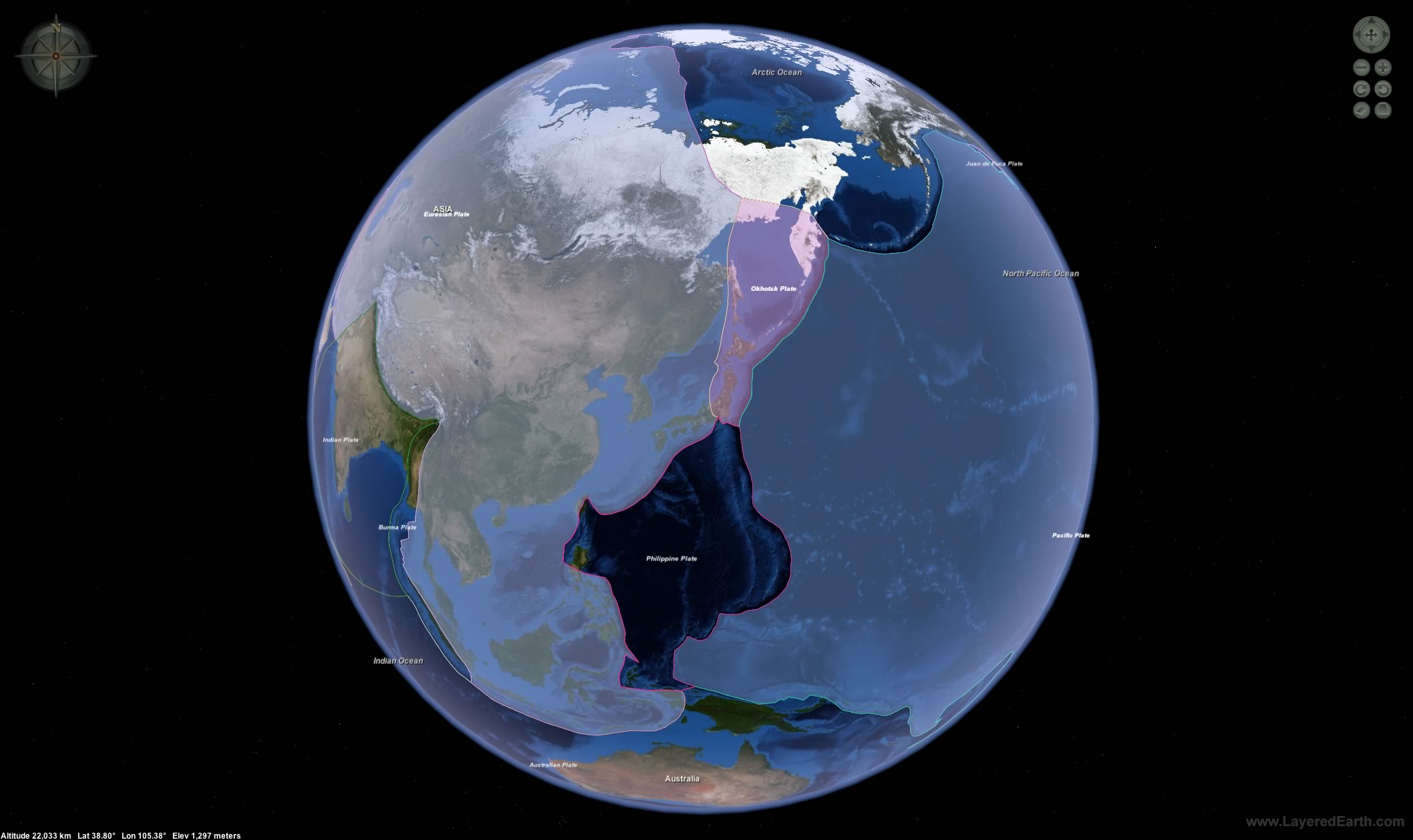
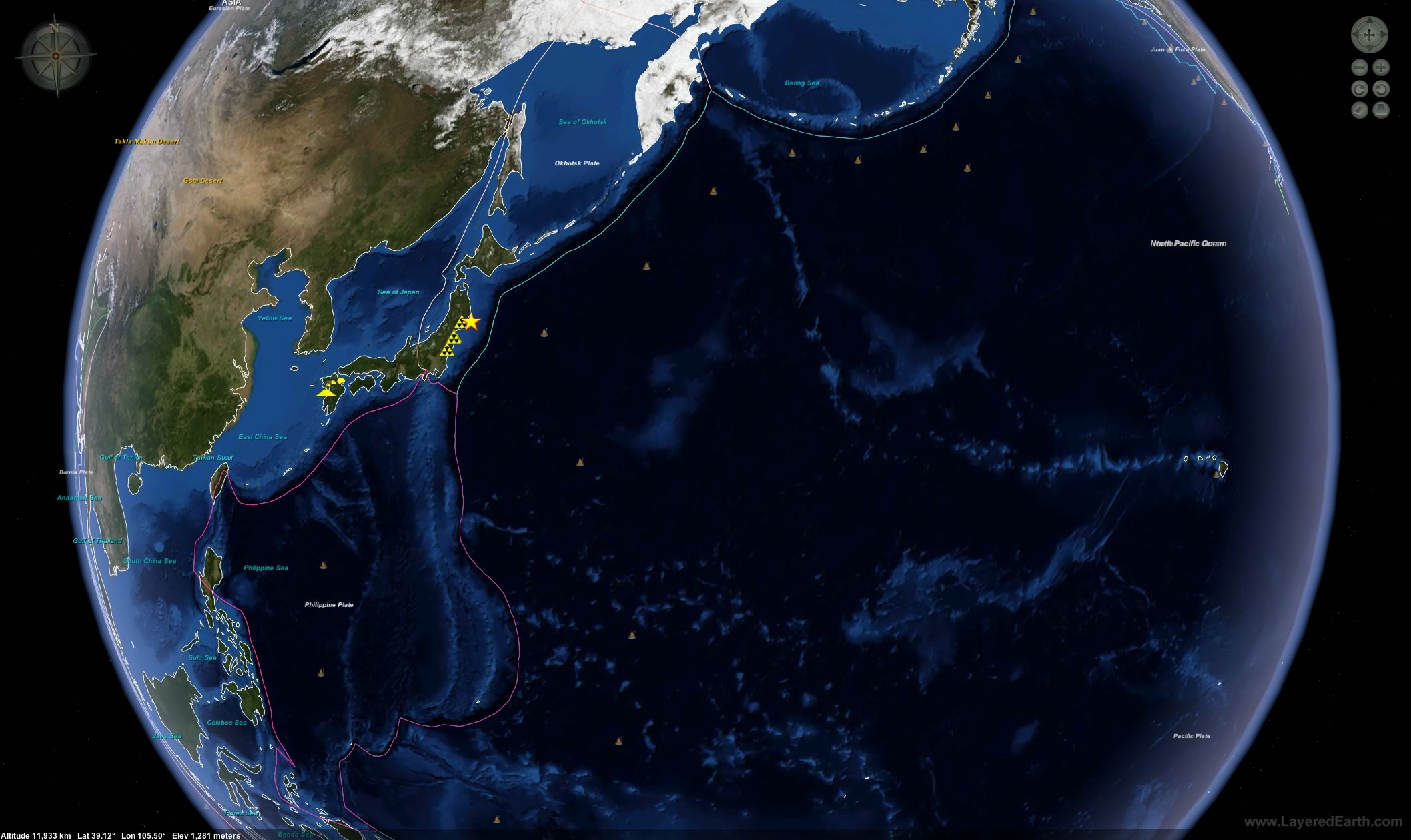
 Japan & Tectonic Plates
Japan sits on the boundaries of four tectonic plates; the Pacific plate, the Philippine plate, the Okhotsk plate and the Eurasian plate.
Download this image -
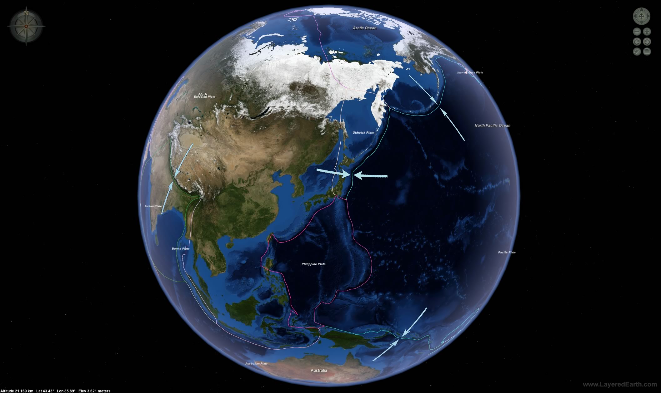
 Tectonic Plate Motion
The March 11, 2011 Honshu earthquake was caused by the Pacific plate sliding under the Okhotsk plate at a convergent boundary. A convergent boundary represents an area where two plates are moving toward one another, or converging.
Download this image -
 The Japan Trench
The movement of the Pacific plate under the Okhotsk plate has resulted in the formation at the plate boundaries of a deep oceanic trench known as the Japan Trench. The Japan Trench has a maximum depth of 9,000 m (19,500 ft).
Download this image -
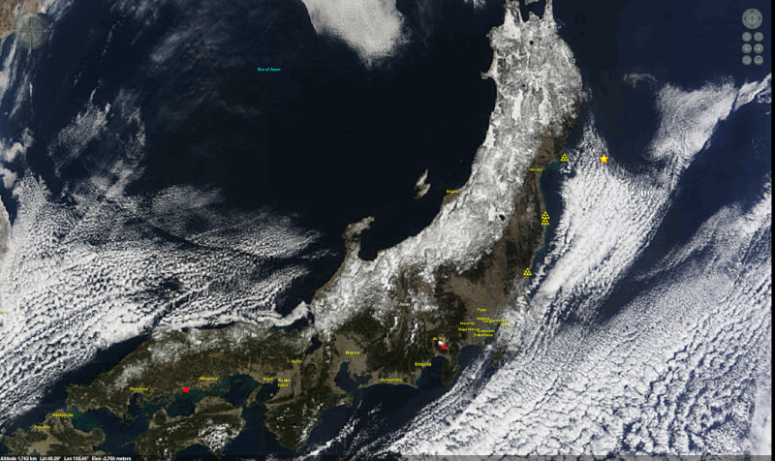
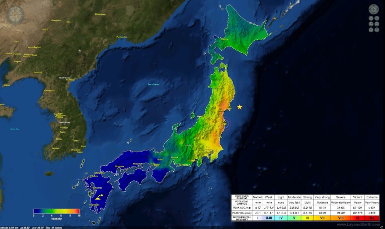 Earthquake Shaking Intensity
A shake map for the Honshu earthquake. A shake map shows ground movement and shaking intensity for an earthquake. Notice how the shaking intensity of the earthquake was higher near the earthquake epicenter (yellow star marker). Several nuclear power plants (triangle markers) are located in areas that experienced severe shaking.
Download this image -
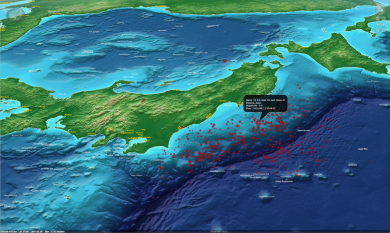
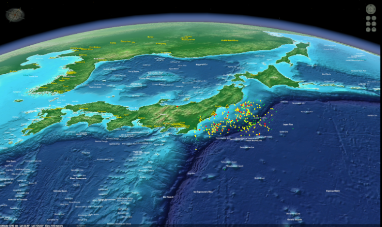
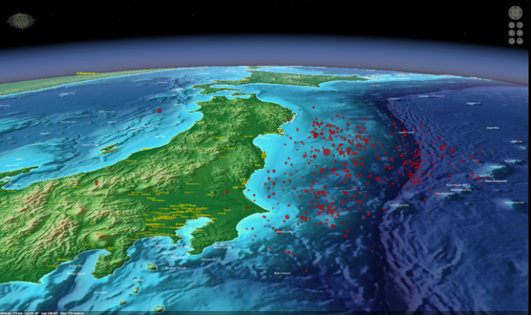
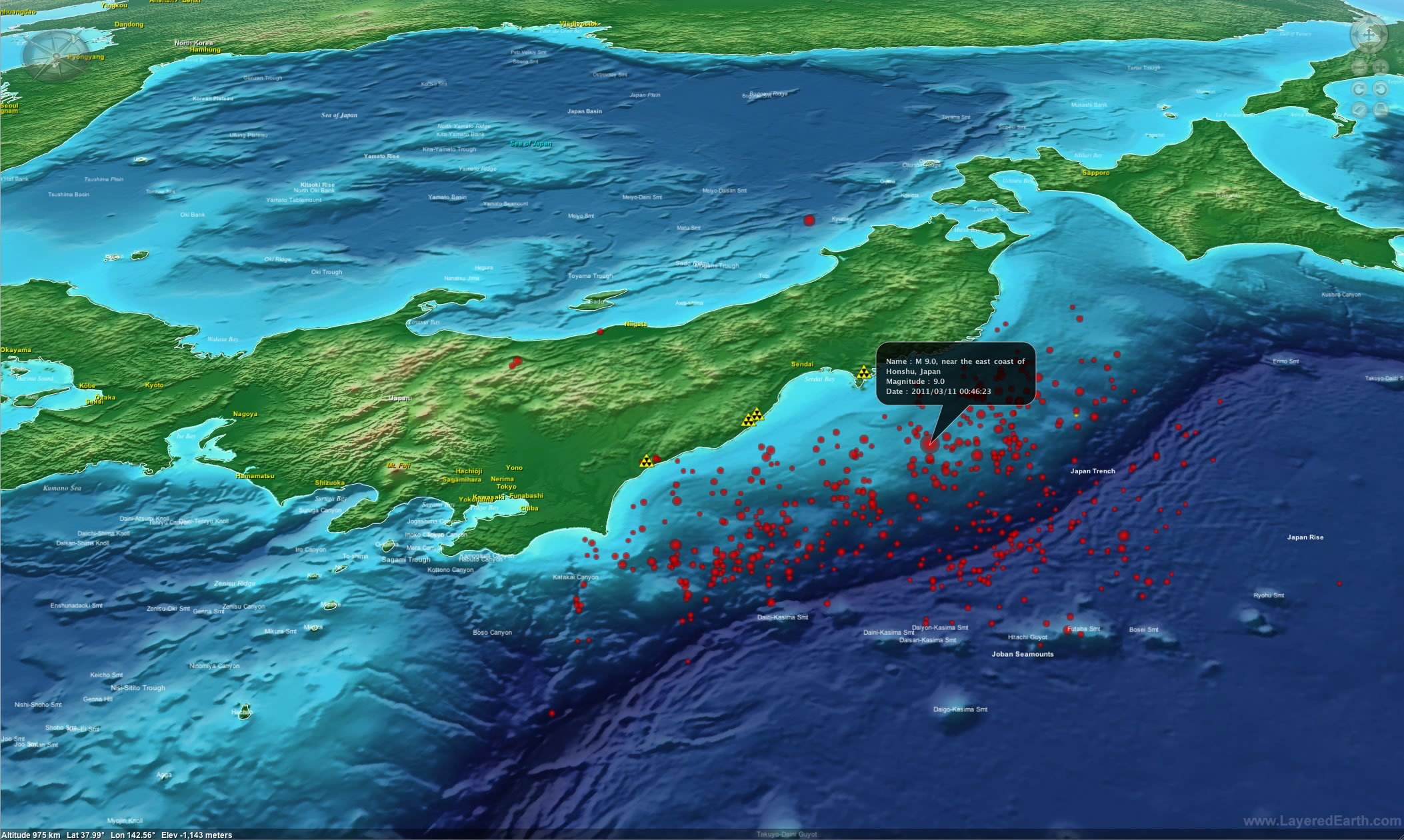
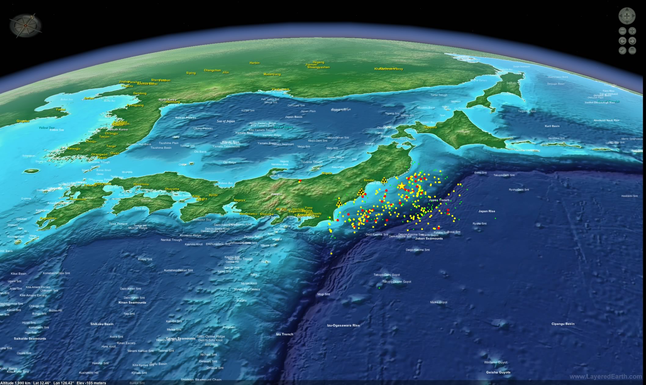
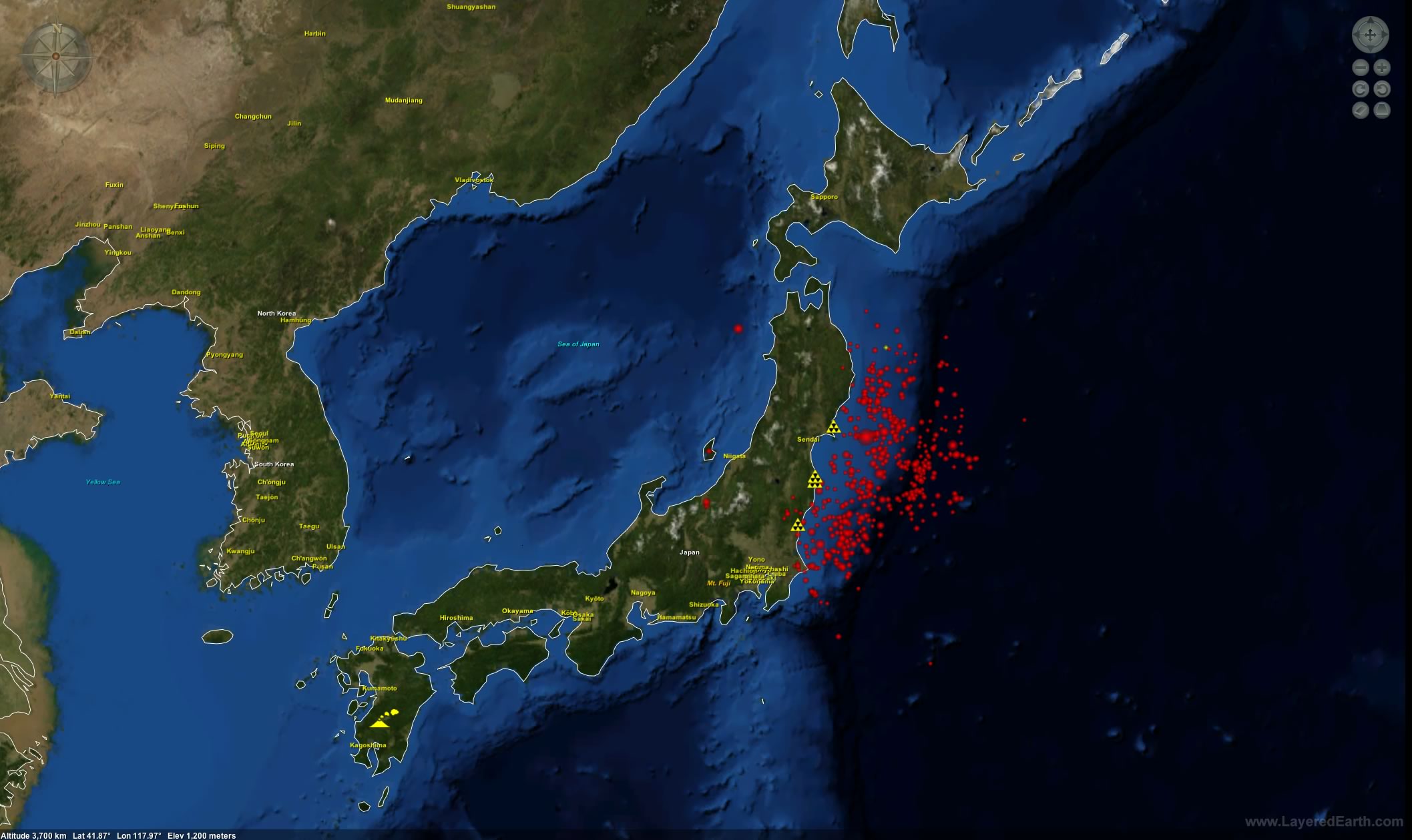
 Epicenter & Aftershocks
Japan has continued to experience a large number of smaller earthquakes following the catastrophic March 11 earthquake.
Download this image -
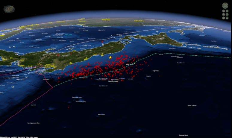 Aftershocks & Magnitude
These smaller, subsequent earthquakes are known as aftershocks. They may substantially extend the damage and reach of the original quake, and may last for weeks, months or years.
Download this image -
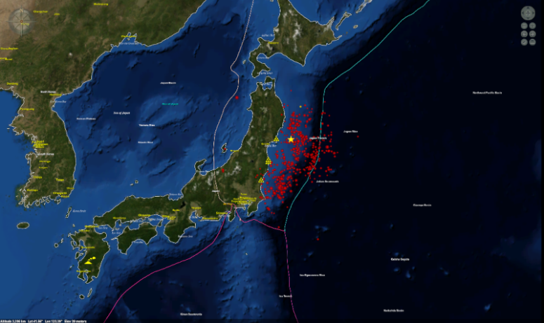
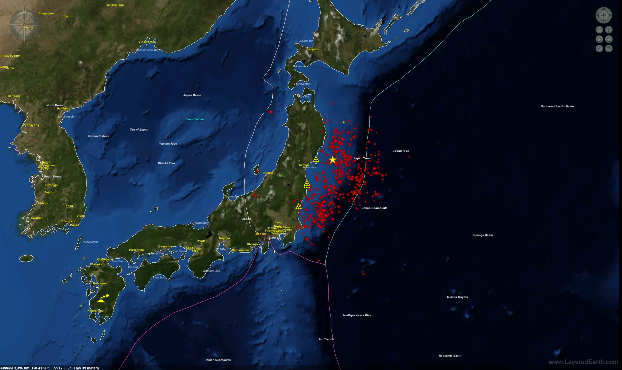
 Magnitude & Plants
The location of the Onagawa, Fukushima Daiichi, Fukushima Daini and Tokai nuclear power plants are highlighted with triangular markers. A star indicates the epicenter of the March 11 earthquake. Red represents magnitude 6+ aftershocks, yellow shows magnitude 5-6 aftershocks and green is aftershocks of less than magnitude 5.
Download this image -
 Effect on Earth's Rotation
The Honshu earthquake was so powerful that the island of Honshu moved 2.4 meters to the east. This slight shift in the Earth's mass has resulted in a slight increase to the Earth's speed of rotation by 1.6 microseconds, thereby fractionally shortening the length of the Earth's day.
Download this image -
 Tsunami DART buoys
A worldwide series of early-warning sensors known as DART buoys (Deep Ocean Assessment and Reporting of Tsunamis), provided advance warning for tsunamis.
Download this image -
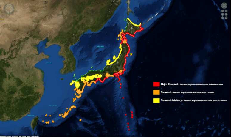 Tsunami Wave Height
On March 11, 2011 a tsunami warning was issued for Japan. The areas highlighted in red represent an estimated tsunami wave height of 3 meters or more.
Download this image -
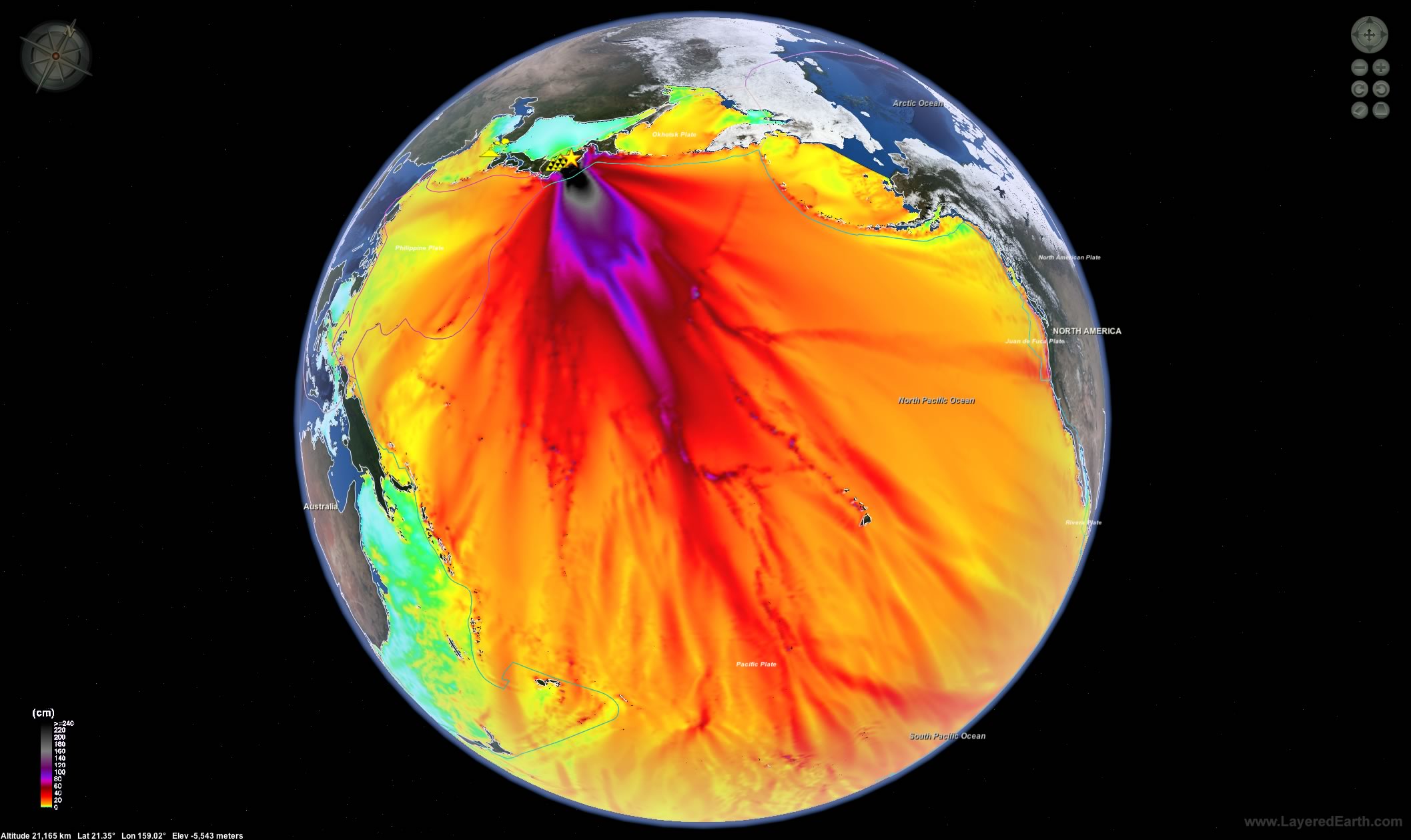
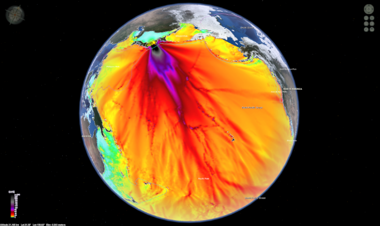 Tsunami Energy Map
The estimated tsunami wave heights in the Pacific basin; dark colors indicate where the force of the tsunami was directed.
Download this image -
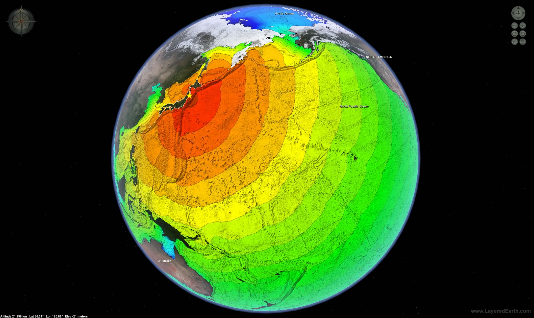
 Tsunami Travel Time Map
The tsunami travel-time map shows, in hours, how long it took the March 11th tsunami to travel through the Pacific Basin.
Download this image -
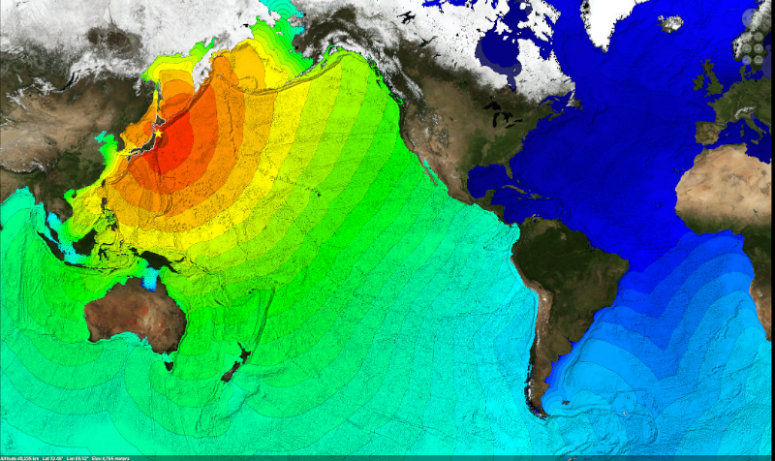 Mercador Tsunami Map
This mercador projection shows, in hours, how long it took the March 11th tsunami to travel through the Pacific Basin.
Download this image -
 Japan & Sendai City
Coastal areas of Japan, including the city of Sendai, suffered catastrophic damage from a 10-meter (33 foot) high tsunami.
Download this image -
 Fault Lines
The Fukushimi nuclear power stations were both heavily damaged by the tsunami. The northern station, Fukushimi Daiichi, has provoked particular concern due to damaged backup cooling systems needed to remove heat from the reactor's radioactive fuel.
Download this image -
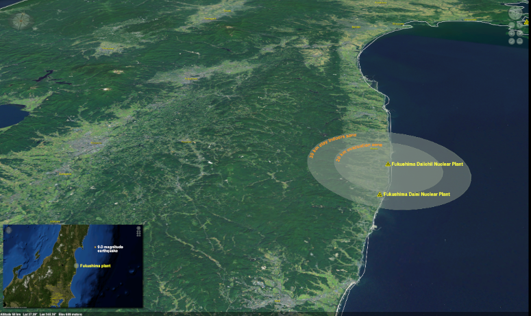 Fukushima Daiichi Nuclear Power Plant
Japanese government officials have informed people living within 20 kilometers of the Fukushima Daiichi Nuclear Power Plant to evacuate, and people within 30 kilometers to stay indoors.
Download this image -
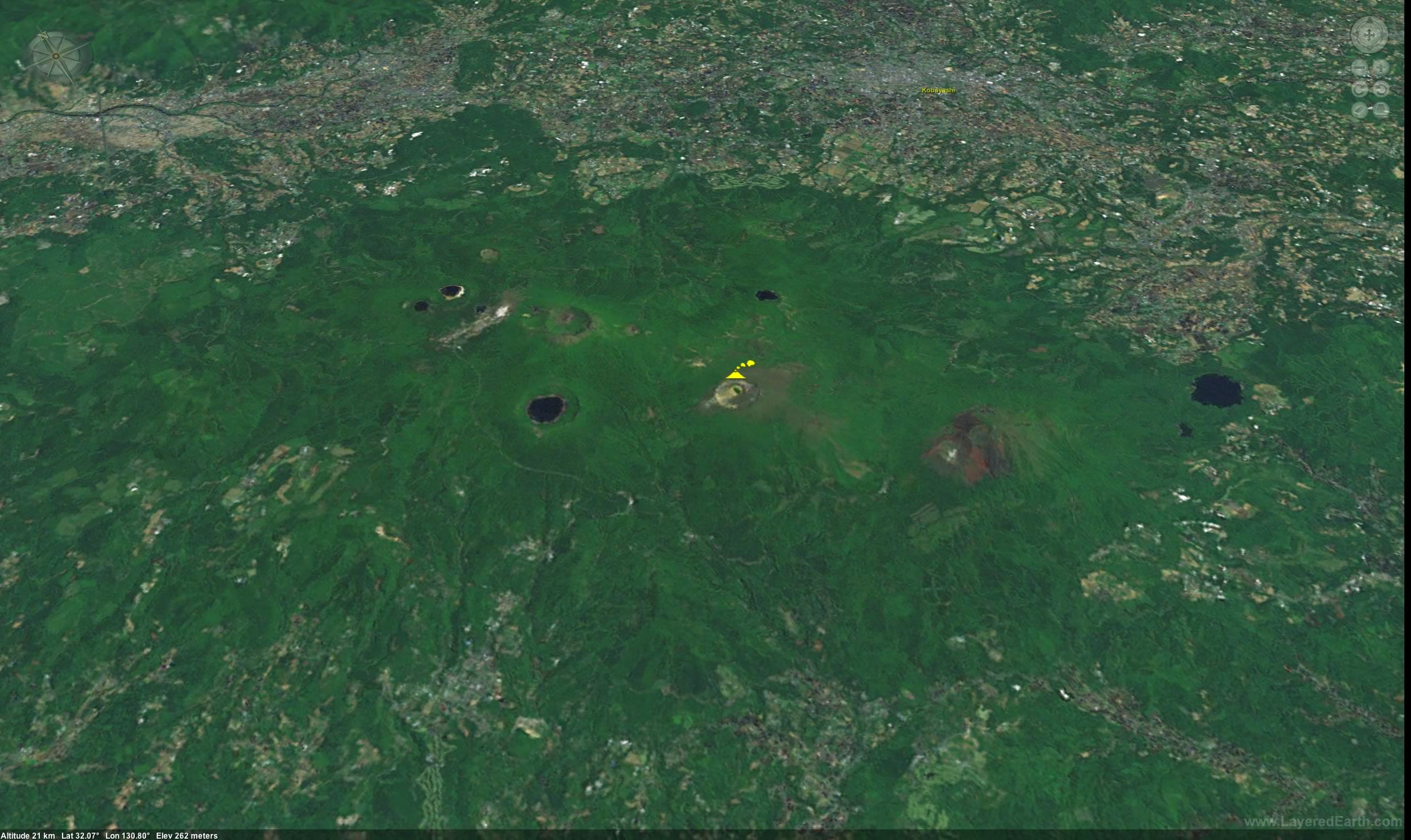
 Shinmoedake Volcano
On March 13, 2011, the Shinmoedake volcano in southern Japan erupted (seen as a yellow volcano icon). In addition to earthquakes, colliding plates can also form new volcanoes or build up old ones. Whether there is a link between the March 11 earthquake and the March 13 eruption is not certain.
Download this image -
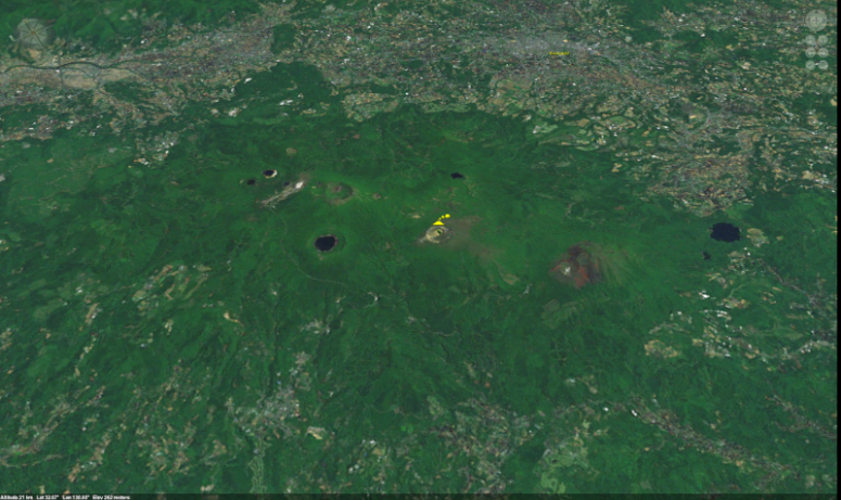 Shinmoedake Volcano Closeup
Download this image
Download this Lesson in PowerPoint.
Download this Lesson in Hi-Res Slides.
Educational Interactives: Earthquake Fault Types & Tsunamis
The Honshu earthquake occurred along a thrust fault; demonstrate tectonic plate interaction and earthquake fault types with this interactive simulation.
Enlarge.Teach the mechanisms behind Japan's tsunami with this hands-on, interactive simulation.
Enlarge.